The drive has been gorgeous since crossing into Canada. At first, none of the vistas were better than those I see in the US Rockies! The Okanogan Valley reminded me of the St.Joe River area in Northern Idaho, while the North Thomson River Corridor was quite similar to the drive from Missoula over Lolo Pass and down to Lewiston, ID. The northernmost part of the drive today, along the Cariboo Mountains, was like many gorgeous high country drives in Colorado. I felt some pride – so far the Canadian Rockies have nothing over the US Rockies. That probably would not have been the case if I had turned east towards Jasper and the glaciers instead of west towards Prince George! Right now, I am considering driving into the Jasper area on the way back south.
The one thing that is different here: In Colorado, you are into and then pass out of the Rockies (on I-70) in less than a day’s driving. Here, you drive all day and there are always more mountains around the next corner. And the next, and the next. The mountains continue on forever.
As expected, the terrain reverted to early, early spring once I turned west on the Yellowhead Highway, towards Prince George. The signs that had previously warned me about having Snow Tires and Carrying Chains from Sept 15-March 31 now said Sept 1 – Apr 30. So, I lost a month in terms of spring weather. The snow was mostly gone and the roads perfectly clear. However, in the shady northern spots, late snow clung like barnacles to the slopes. The ground seemed a bit muddy for camping and I decided to get a room with a kitchenette in Prince George. Shower! Hot food! A bed! TV! Hot coffee! Wi-Fi! Email! News! Facebook!
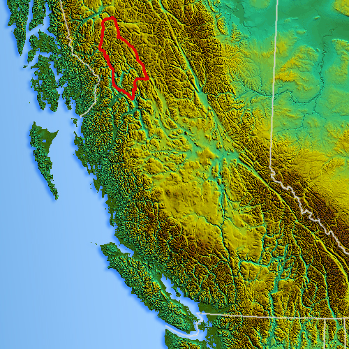
Skeena Mountains
That sense of familiarity changed the next day, about 100 KM to the west of Prince George. The mountains were much lower and less dramatic, but I entered the Lake District, which was a beautiful as it sounds. Lakes everywhere, some with a bit of ice left away from the shorelines. About 250 KM west, I approached the Babine then the Hazelton Mountains, part of the lower majestic Skeena Range. Once in these mountains, I drove through the most beautiful scenery ever. The heavily snow-covered mountains were jagged and rugged, like those in Central Colorado. At least one peak had a glacier on the north side! So exciting. Not my first glacier, thanks to a visit to Glacier National Park about 10 years ago, but the closest I have ever been to one. These mountain peaks seemed so close. In my mind I can explain why, but it is difficult to articulate. Maybe this: the mountains look like any 14er in Colorado (right now for illustration I am thinking of Blanca Peak in Southern Colorado). However, because I am so far north, the mountains right here – no matter how majestic — only rise up to around 7,500 feet. So, it is like the other 6500 feet of rise was cut out from underneath, leaving only the top half of the mountain. Therefore, when you look up from the road to the peak, it is half as far up as the peaks in Colorado. So, the peak terrain and details are quite a bit more visible. Add to that: that roads wind quite close to the base so I feel sometimes as if I can touch the mountains.
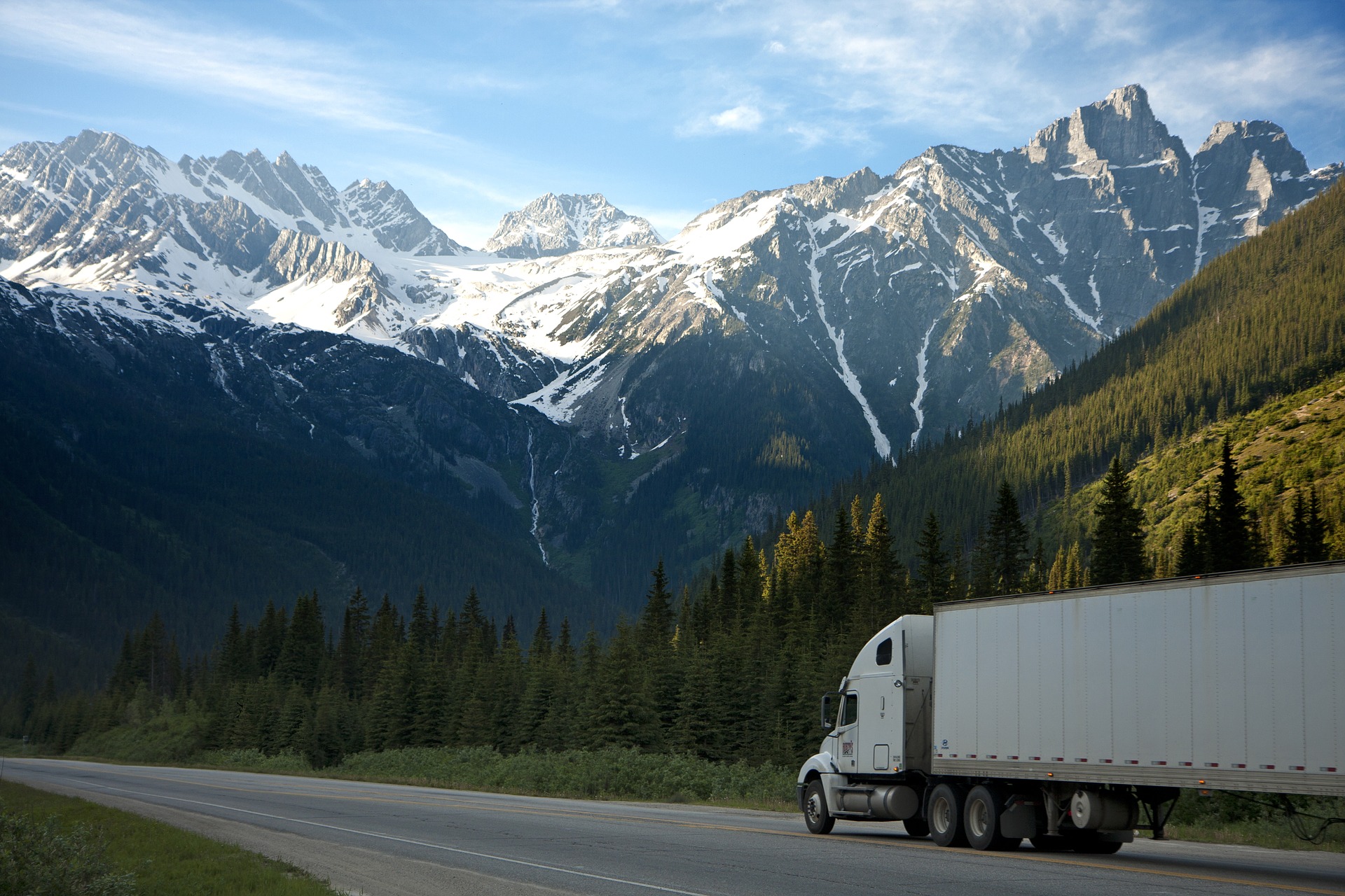
Anyway, the road followed several wide rivers which just added to the majesty. And, I found Spring again. The hardwoods were blooming and small waterfalls fell from the cliffs along the roadside. No wildlife sightings yet, but I did pass tons of blooming Western Skunk Cabbage. In a beautiful example of the interconnectedness of all things, I read the following:
“While some consider the plant to be a weed, its roots are food for bears, who eat it after hibernating as a laxative or cathartic.”
I stopped for the night only 100 miles west of Prince Rupert. With such a short distance to travel, I slept in that next morning. That last bit of road was lovely although the day was overcast. The wide Skeena river spread out even more, and eventually became tidelands. Such a sweet transition.
I am happy that this driving segment is over. Three days plus a small amount this morning. With three nights total in motel rooms, I am about $20 over budget for lodging but came in about $20 under budget on gas. Voila! I love it when that happens.
Tonight, I am in a cool hostel in Prince Rupert. It is a beautifully restored old house near the cruise ship docks. I have a private room that is IKEA-Euro style. Quite trendy. I love hostels and haven’t’ been in one for about 10 years. When I lived in CO, I did quick R&R trips to Taos and stayed in a hostel there. So, it was wonderful to check-in to another. People of all ages now use hostels and most offer private rooms or the traditional dormitories. I am enjoying a private room and bath right off the living room. The staff person moved me to this room instead of the one I reserved because of recent changes in their dog policy, which limits dog guests to this one room near the front door. Thank goodness it was available for my sweet dog. Because of the modern styling, the room is by far nicer than the cheapo motels where I stayed. I love the travel-oriented hostel vibe that permeates the group spaces: a shared kitchen and central group area with computers and sofas. I saw a car from Vermont in the parking lot; I am not the only crazy out and about so early.
After settling in, I reviewed all the ferry information and discovered that I need to check-in 3 hours early, at 7:45 AM local time. I packed up my “ferry” bag and the small cooler bag to keep with me on deck (the car stays below). The ferry bag has long underwear, my blanket poncho, water, gloves, hat, rain slicker, Kindle, Chromebook, cords and lots of quarters for vending machines.
I will meet up with some rain again in Wrangell, AK, but it looks like a short break just in time for me to put up the tent!
A few notes about road travel in BC:
- When I arrived at the border crossing the Canadian guy only looked at my passport. Before crossing, I had pulled out Tangos papers, the car registration, and proof of insurance. The guy ran my passport through the computer. He asked about firearms, made some small talk, and watched my face to see if I was hiding anything. He seemed to be waiting for something to show on the computer. Then he said, You have never been in Canada before?” and I said not in 40 years or so! Then he asked me why I was in Canada and then sent me on my way. Nothing to it. Surprised about not wanting to see Tango’s shots record based on pre-trip feedback from others.
- Southern BC is quite modern and full of all the classic U.S. big box stores like Home Depot and Walmart. Except for the kph signs, I could have been in any quaint Washington town. The further north I head, the more I drive through the north woods territory of my daydreams.
- I am asked to sign a receipt every time I use my debit card up here. It runs like a credit card, not a debit. For that reason, I can’t pay at the pump but have to go inside and sign for my purchase.
- A tank of gas is around $30 in the US now. Here is it $45.00. I planned for that in my budget.
- Food is quite cheap, though.
- BC is quite friendly to campers. I passed tons of (closed) Provincial Parks and private campgrounds. Most of the private RV parks here say either RV and Tent Camping or RV Golf Resort. Apparently, golfers like to RV and vice versa.
- I saw so many signs warning about driving in a wildlife corridor, but I have not seen anything other than 3 deer. Darn. The signs show images of deer, moose, elk, and bear. My wildlife jinx holds.
- These folks like fresh bakery stuff. At my first break stop on day two, the convenience store had its own bakery and a beautiful display of good stuff. I had not eaten yet and was happy to find a dark bran muffin.
- The Yellowhead Highway is mostly two-lane with lots of passing lanes on the up and down hills. Also, clever people decided to put rustic but sweet rest stops about every 30 miles.
- Safeway is a common grocery store here, with better than average Safeway bakeries.
One last note: I hit the 4000-mile mark, in terms of total miles traveled since leaving NM!!! The following map illustrates the distance I have traveled! That little white dot right in the middle of the globe is where I am at the moment! That latitude line below passes close to the Mexico border. Wow! Yes, it is after 9 PM and quite light outdoors.
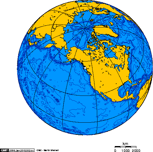
According to this map, I am closer to Russia than I am to New Mexico.


